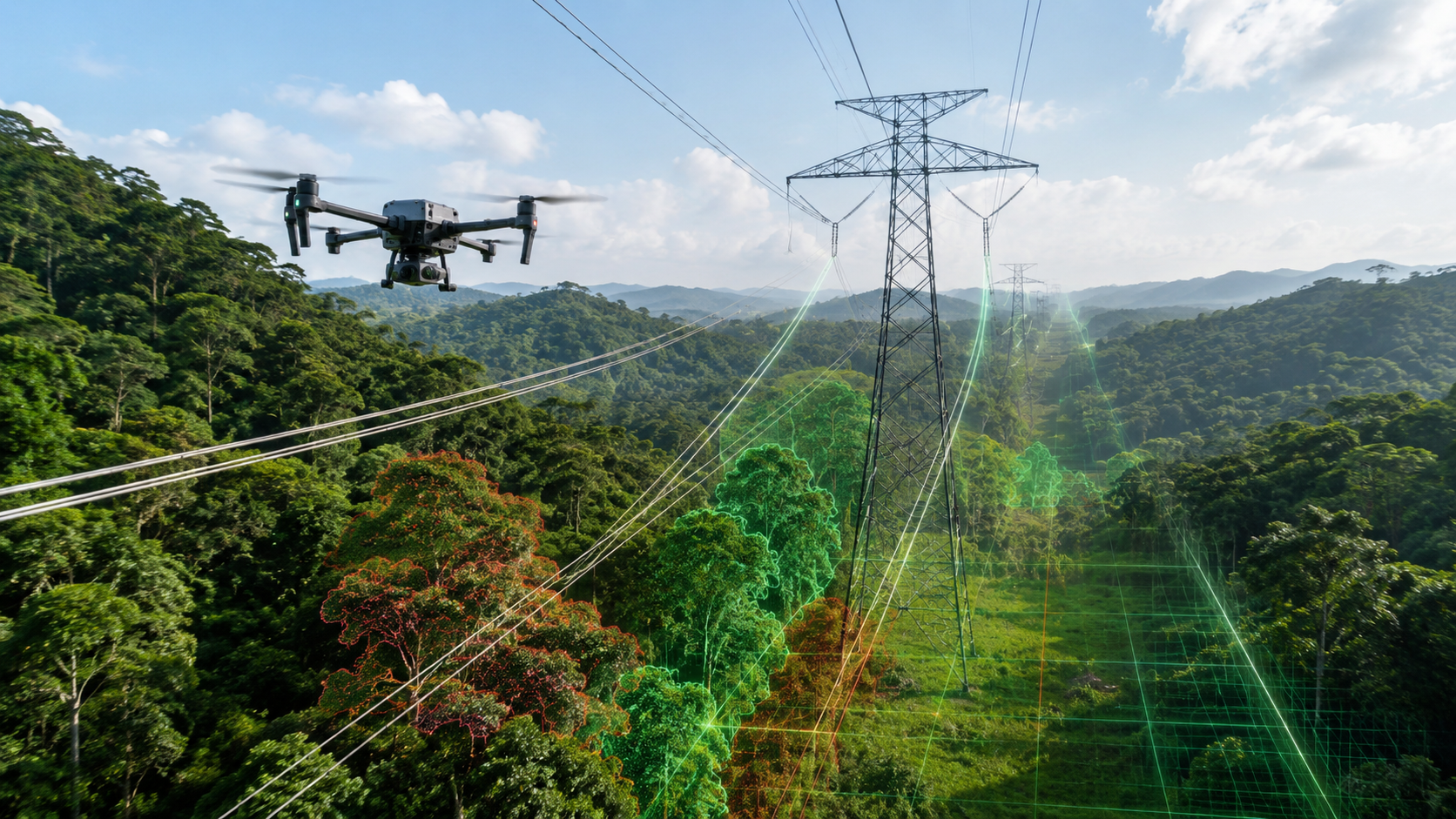
Vegetation encroachment is one of the toughest recurring risks around overhead power lines. Drones and AI give utilities a faster, safer, and far more consistent way to monitor corridor clearance, catch growth risks early, and prioritize crews before an outage happens.
Why vegetation encroachment is a serious grid risk
Power lines rarely run through clean, easy-to-manage terrain. They cross forests, farmland, mountains, river valleys, residential edges, and remote corridors where the vegetation picture changes with every season. Trees grow. Branches bend in the wind. Storms shove foliage into conductors. New growth pops up in areas that looked safe just months earlier.
For utilities, vegetation encroachment isn’t just a maintenance issue. It hits grid reliability, public safety, wildfire prevention, outage response, and regulatory compliance all at once. Once a tree or branch gets too close to an overhead line, you’re looking at flashover risk, conductor contact, equipment damage, and access problems for the crews who need to fix it.
The real challenge is scale. A single utility might be responsible for thousands of miles of corridor — each with its own terrain, tree species, growth patterns, weather exposure, and access conditions. Manual patrols catch the obvious problems, but they’re slow, inconsistent, and hard to repeat at the level of detail modern grid operations demand.
Vegetation management works best when utilities catch risk early, measure it consistently, and route crews before a clearance issue becomes an outage.
Why manual vegetation patrols fall short
Traditional vegetation inspection still leans heavily on ground crews, helicopter patrols, handheld photos, and field reports from local teams. These methods have real value — especially for physical trimming, on-site verification, and emergency response. But for large-scale corridor monitoring, they hit their limits fast.
Ground patrols are bounded by roads, terrain, weather, visibility, and crew availability. Helicopters cover distance but drain budget and can be a nightmare to schedule. And manual reporting varies from person to person: one crew tags a tree as urgent, the next crew calls the exact same condition a routine follow-up.
That inconsistency is the killer. Managing vegetation risk across a large grid takes inspection data that’s repeatable, geo-referenced, easy to compare over time, and tied directly into maintenance planning — not a stack of subjective field notes.
How drones change the game
Drones make vegetation monitoring practical at scale by giving utilities a flexible way to capture corridor imagery from above and along the line route. Instead of depending on what ground crews can see from an access road, drones deliver clean views of conductors, towers, surrounding trees, terrain, and right-of-way conditions — from the angles that actually matter.
Planned flights turn inspection into a repeatable workflow. The same corridor sections get reviewed across seasons, after storms, or before scheduled trimming cycles. That makes it straightforward to compare growth over time and understand whether a risk is stable, worsening, or already brushing up against the clearance threshold.
For remote or difficult terrain, drones also cut down on unnecessary field exposure. Aerial screening covers the wide areas first, and trimming or verification crews get sent only where the data says there’s a real reason to go.
Where AI adds real value
Drone imagery on its own is useful. AI is what turns a mountain of corridor data into decisions utilities can act on. A single mission can produce thousands of images or video frames — reviewing every one by hand is slow work, and standardizing it across reviewers is even harder.
AI vision systems flag vegetation near conductors, classify risk zones, mark sections with possible clearance issues, and organize findings by location. Layer in mapping data, line asset records, and historical inspection results, and AI takes utilities from ad-hoc image review to structured vegetation risk management.
Drones capture the corridor. AI decides which parts of that corridor need attention first.
WThink’s Power Transmission solution is built around this connected inspection model — bringing drone inspection, Industrial AI, edge computing, 5G connectivity, and centralized O&M workflows together for smarter grid monitoring.
What drones and AI can monitor along power lines
Vegetation risk is rarely as simple as a branch touching a wire. Utilities need to understand growth direction, clearance distance, terrain, tree height, seasonal patterns, and how the vegetation will behave when wind, rain, or wildfire conditions kick in.
Tree-to-line proximity
Trees and branches growing too close to conductors, towers, insulators, or other energized assets — flagged before they become a contact risk.
Right-of-way overgrowth
Vegetation inside the corridor that blocks access, eats into clearance, or complicates every future maintenance visit.
Fast-growing risk zones
Cross-cycle comparison surfaces areas where growth is outpacing the surrounding corridor — the spots that need attention next.
Storm and wind exposure
Leaning trees, broken branches, unstable canopies, and vegetation likely to swing into conductors during severe weather.
Wildfire-related risk
Dry vegetation, dense growth, and corridor segments where access is limited — exactly the sections that demand closer review in fire season.
Access and maintenance constraints
Terrain, blocked roads, and site conditions that affect how — and how quickly — trimming crews can actually get to the work.
How AI helps prioritize vegetation work
No utility has unlimited trimming crews or an open-ended budget. The real payoff of AI vegetation monitoring isn’t just detecting trees — it’s helping teams figure out which risks earn attention first.
AI-assisted workflows group findings by location, severity, asset type, corridor section, and likely operational impact. From there, it’s easier to sort what needs immediate trimming, what can wait for the routine maintenance cycle, and what should just be re-inspected next round.
The result: vegetation teams stop treating every finding the same. A branch pushing a high-voltage conductor in a wildfire-prone area gets escalated fast. A slow-growth section well clear of the line gets a seasonal watch instead of a truck roll. Structured AI data makes those distinctions obvious.
Where 5G and edge AI come in
Vegetation monitoring plays out across long corridors where connectivity, terrain, and field access rarely cooperate. 5G and edge AI are what make the workflow responsive instead of clunky.
5G lets drones stream live video, telemetry, mission status, and inspection data straight back to a control center or field platform. Remote teams review corridor conditions while the mission is still active — no more waiting for someone to land the drone and download the card.
Edge AI shifts the first pass of analysis closer to the field. Instead of shipping everything to the cloud first, edge devices handle preliminary detection, image quality checks, abnormal condition alerts, and faster triage — right where the drone is flying.
WThink supports these connected inspection workflows with products like the M3X 5G drone data link module, WD5500 edge AI module, and Autonomous Inspection System.
A practical drone-based vegetation monitoring workflow
Define corridor sections and risk zones
Nail down line routes, tower locations, right-of-way boundaries, vegetation-dense areas, and the historical outage or trimming record for the corridor.
Collect aerial imagery and corridor data
Drones fly the route and capture visual data, video, geo-referenced location tags, and the site context AI will need for analysis.
Use AI to identify vegetation risks
AI systems flag trees, branches, overgrowth, clearance concerns, and any abnormal corridor conditions worth a second look.
Rank findings by urgency
Findings get organized by location, severity, asset impact, access difficulty, and recommended maintenance priority — ready for scheduling.
Schedule trimming or field verification
Vegetation crews take those inspection results and turn them into targeted trimming, high-risk verification visits, and updated maintenance records.
Compare growth over time
Repeat inspections show what’s growing, validate completed trimming, and sharpen future vegetation planning cycle after cycle.
Benefits for utility vegetation management teams
Faster corridor screening
Drones cover far more right-of-way distance than a ground crew — and skip the sections that don’t need boots on the ground yet.
More consistent risk records
AI classification standardizes how vegetation findings get documented — no more one-crew-says-urgent, another-says-later.
Better trimming prioritization
Crews get pointed at the highest-risk locations instead of working off broad patrol reports and best guesses.
Less field exposure
Aerial screening keeps crews out of difficult terrain until targeted verification is actually needed on the ground.
Fewer preventable outages
Early detection of clearance and growth risks means utilities move on problems before they turn into service interruptions.
Long-term vegetation intelligence
Historical inspection data reveals growth patterns and sharpens the timing on every maintenance cycle that follows.
What to think about before rolling this out
Drone and AI vegetation monitoring pays off when utilities design the workflow around operational reality — not around the technology in isolation. That means locking in inspection frequency, data standards, corridor priorities, risk categories, clearance policies, and the handoff rules between inspection teams and vegetation management crews.
Practical variables matter too: image quality, flight altitude, camera angle, weather conditions, seasonal timing, terrain access, network coverage, and how findings will actually flow into the existing work order or asset management system.
The goal isn’t a folder full of aerial images. The goal is a repeatable decision system that tells vegetation teams where to go, what to inspect, and what to trim first.
Where WThink fits in
WThink supports power line inspection with Industrial AI, 5G connectivity, edge computing, autonomous inspection systems, and AI-powered software platforms. Together they help utilities collect corridor data, catch vegetation and equipment risks, move field information reliably, and turn findings into maintenance workflows the operations team will actually use.
For transmission operations, WThink’s Power Transmission solution covers corridor monitoring, drone inspection, AI defect recognition, live data transmission, and centralized O&M management under one roof.
Bring drones, AI vision, edge intelligence, and connected inspection platforms together, and utilities move from reactive vegetation response to genuinely predictable corridor management.
Vegetation encroachment monitoring for power lines matters more every year — larger networks, tougher weather, and steeper reliability expectations all pushing in the same direction. Drones give utilities the aerial visibility to inspect long corridors safely and efficiently. AI turns that data into risk-ranked maintenance intelligence. Connect the whole system with 5G, edge AI, and a centralized inspection platform, and vegetation monitoring gets faster, more consistent, and more effective at preventing outages before they start.
Frequently asked questions
What is vegetation encroachment monitoring for power lines?
It’s the process of inspecting trees, branches, and vegetation growth near power lines to identify clearance risks, right-of-way overgrowth, and conditions that affect grid reliability or safety.
How do drones help monitor vegetation near power lines?
Drones capture aerial imagery and corridor data from angles ground patrols simply can’t reach, making it possible to inspect long or hard-to-access power line routes far more efficiently.
How does AI detect vegetation risks?
AI vision systems analyze drone imagery to identify trees, branches, overgrowth, clearance concerns, and shifting vegetation patterns along transmission corridors — at a speed and consistency manual review can’t match.
Can drone-based vegetation monitoring reduce outages?
Yes. Catching vegetation problems earlier and prioritizing trimming or field verification before conditions worsen is one of the most reliable ways to knock down outage risk on a large grid.
Why combine drones, AI, 5G, and edge computing?
Drones collect the data. AI identifies the risk. 5G moves it in real time. Edge computing processes it close to the field. Together they turn vegetation monitoring into something fast, connected, and actually decision-ready.