

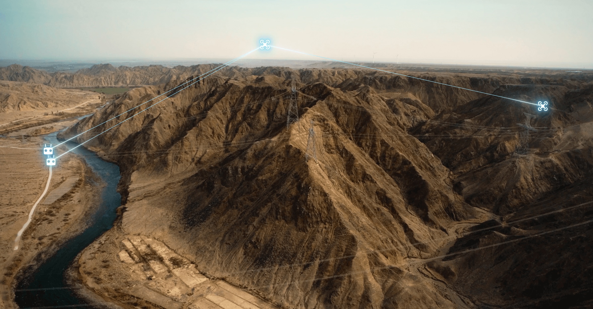
Project Background and Mountainous Communication Barriers
High-voltage power transmission corridors often span hundreds of kilometers across highly rugged and mountainous terrains, crossing deep valleys, high ridges, and dense forests where traditional cellular coverage is completely absent. Conducting routine inspections along these long-distance corridors is vital to prevent major grid outages caused by vegetation encroachment, insulator failures, landslide damage, or physical line breaks. While industrial drones are highly effective for surveying power grids, mountainous terrain presents severe communication barriers. Rugged mountain ridges act as physical walls that block direct line-of-sight radio signals between the ground control station and the inspection drone, resulting in immediate control link disconnection and live video feed loss behind the nearest ridge.
Limitations of Traditional Remote Inspections
Due to these severe terrain and signal blockage constraints, the effective range of standard inspection drones was historically limited to just a few kilometers. To maintain a stable communication connection, ground inspection teams had to frequently pack up their gear, hike through treacherous mountain paths, and establish new launch points within line-of-sight of the next transmission towers. This highly manual, localized approach was physically exhausting, slow, and made large-scale Beyond Visual Line of Sight (BVLOS) inspections impossible to execute. To improve operational efficiency and cover vast stretches of rugged mountain corridors safely, the utility company required a high-bandwidth communication system that could bypass physical terrain blockages.
Implementing WThink’s 5G Relay Solution
To overcome these signal blockage challenges, the utility deployed WThink’s 5G Relay Communication Architecture across its mountain inspection sectors. This advanced communication system utilizes a specialized, high-altitude UAV relay node to establish a high-bandwidth, low-latency private 5G network chain between the ground base station and the distant inspection drone. By positioning a mid-air relay bridge above the mountain peaks, the system successfully bypasses the physical terrain barriers, extending the reliable control and real-time ultra-high-definition video transmission range beyond fifteen kilometers.
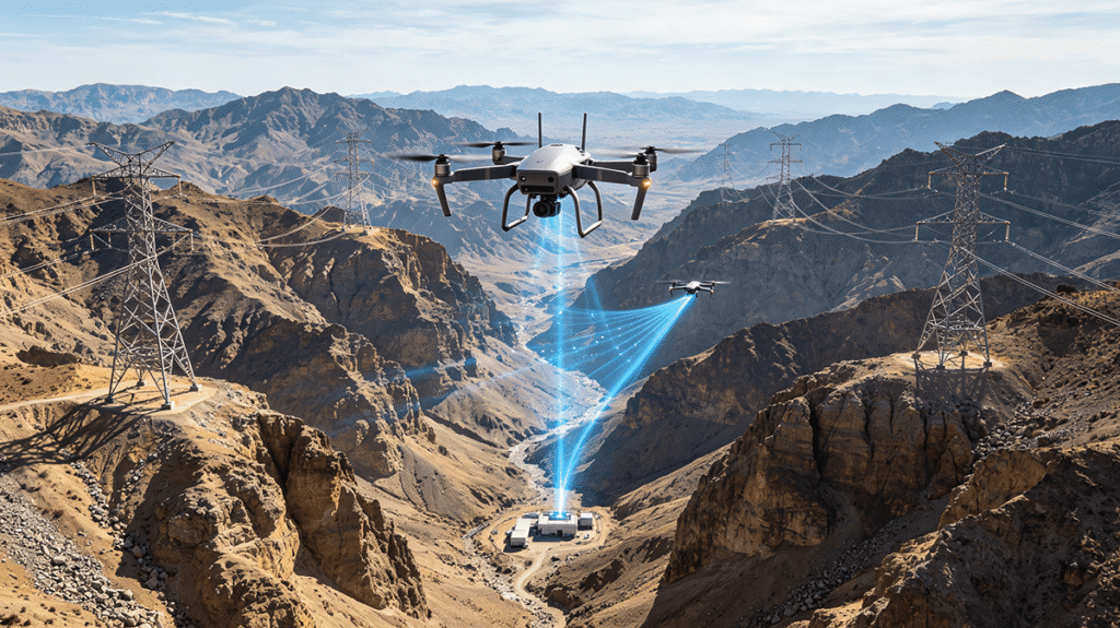
Dynamic Mid-Air Relay and Extended BVLOS Operations
The integrated 5G relay architecture operates through a coordinated dual-UAV flight protocol during inspection campaigns. Upon deployment, a specialized high-altitude relay drone, equipped with WThink’s 5G private network relay station and tracking antennas, ascends to a strategic high point directly above the mountain ridge, maintaining a clear line-of-sight with the ground command base. Simultaneously, the main inspection drone, equipped with a compact 5G terminal, flies deep into the valleys below to scan the transmission towers and conductors. The relay drone captures the control signals from the ground base and rebroadcasts them directly to the active inspection drone, maintaining a continuous, high-speed data link despite the intervening mountain peaks.
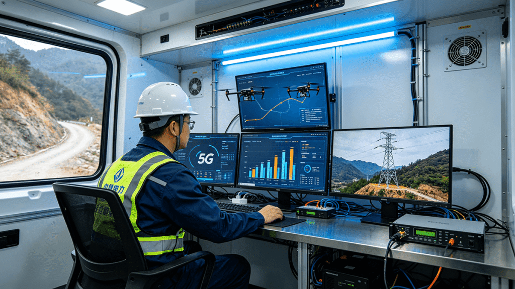
Real-Time Diagnostics and Long-Range Inspection Results
With the stable 5G relay link successfully maintained over fifteen kilometers of rugged mountain terrain, the active inspection drone can transmit ultra-high-definition optical video and thermal infrared feeds back to the ground control station in real time. The engineering team can immediately identify insulation flashovers, loose bolts on tower heads, or safety clearances violated by growing vegetation. The deployment of WThink’s 5G Relay Communication Architecture has successfully resolved the signal blockage challenges of mountain power transmission inspections, reducing the need for maintenance staff to hike treacherous terrain and allowing a single command team to survey vast stretches of rugged mountain corridors in a single automated flight.